Driving Directions


Glasheen Road
NOTE: The campus and office are in different locations. Please call ahead and arrange a meeting place. The campus is deep in the woods and it is very easy to become disoriented on the narrow, unmarked dirt tracks. It is best to arrange to meet us at the campus sign or at the general store in the village of Petersham.
The campus address for GPS is 73 Glasheen Rd., Petersham, MA.
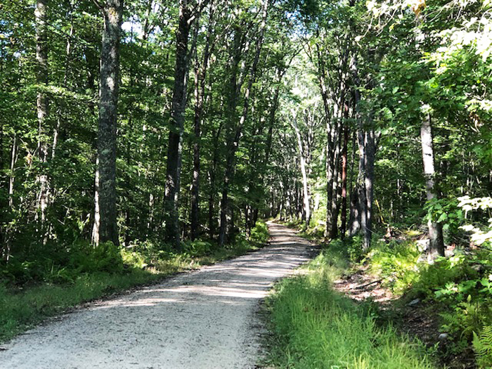
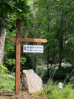
From the West (Greenfield): Take Rt. 2 East from Greenfield to Exit 17. At the end of the exit ramp, turn right onto Rt. 32. Follow Rt. 32 to the village common in the center of Petersham. Bear left at the beginning of the common, staying on Rt. 32. The Petersham County Store will be on your left. Immediately after the store, turn left onto East Street. After about 2 miles, you’ll pass Quaker Drive on your left. Glasheen Road is .3 mile past Quaker Drive. Turn left onto Glasheen Road, which is a narrow dirt road. Go .66 mile to the University of the Wild sign on your left.
From the East (Boston): Take Rt. 2 West from Boston to Exit 21. Take Rt. 101 through Templeton, continuing on Rt. 101 to Rt. 32. Turn left onto Rt. 32 to the village common in the center of Petersham. Bear left at the beginning of the common, staying on Rt. 32. The Petersham County Store will be on your left. Immediately after the store, turn left onto East Street. After about 2 miles, you’ll pass Quaker Drive on your left. Glasheen Road is .3 mile past Quaker Drive. Turn left onto Glasheen Road, which is a narrow dirt road. Go .66 mile to the University of the Wild sign on your left.
From the South (Springfield): Take the Mass Pike (Rt. 90) East to Exit 8. Take Rt. 32 North through Ware, continuing on Rt. 32 to Gilbertville. In Gilbertville, turn left onto Rt. 32A and follow to the junction with Rt. 122. Turn right onto Rt. 122, then left onto Rt. 32 North to the village common in the center of Petersham. Immediately before the Petersham County Store on your right, turn right onto East Street. After about 2 miles, you’ll pass Quaker Drive on your left. Glasheen Road is .3 mile past Quaker Drive. Turn left onto Glasheen Road, which is a narrow dirt road. Go .66 mile to the University of the Wild sign on your left.
From the North (New Hampshire): Take Rt. 32 South through Richmond, NH and Athol, MA. Continue on Rt. 32 to the village common in the center of Petersham. Bear left at the beginning of the common, staying on Rt. 32. The Petersham County Store will be on your left. Immediately after the store, turn left onto East Street. After about 2 miles, you’ll pass Quaker Drive on your left. Glasheen Road is .3 mile past Quaker Drive. Turn left onto Glasheen Road, which is a narrow dirt road. Go .66 mile to the University of the Wild sign on your left.
Gas Stations & Stores
There are no gas stations or convenience stores in Petersham.
The nearest gas stations coming from the west are in Athol (exit 17 on Rt. 2 – turn left at the end of the exit ramp). Coming from the east, the nearest services are on Main Street in Gardner.
There is a general store in Petersham (you can’t miss it – it’s the only store in the village, right on the common). It is a very nice country store with an assortment of groceries, some clothing and books, and a deli/cafe with homemade treats where you can get made-to-order sandwiches. Call them at (978) 724-0000 or check petershamstore.com for their hours.

“Two roads diverged in a wood, and I—
I took the one less traveled by,
And that has made all the difference.”
Robert Frost